After an unprecedented dieback of mangroves in the Gulf of Carpentaria last year, a team from James Cook University’s TropWATER centre are now on a mission to film every mangrove between Cairns and Cape York.
Dr Norm Duke, leader of the JCU mangrove hub research team, said the scientists will fly the coastline north of Cairns up to Cape York – a shoreline distance of more than 1,500 km, between May 28 and June 5.
Aims of the mangrove survey
“The aim of the project is to quantify the condition and health of shoreline habitats in the region. We’ll also stop and take a closer look at key issues and threats to tidal wetlands such as cyclone damaged patches and places threatened by feral pigs and cattle,” he said.
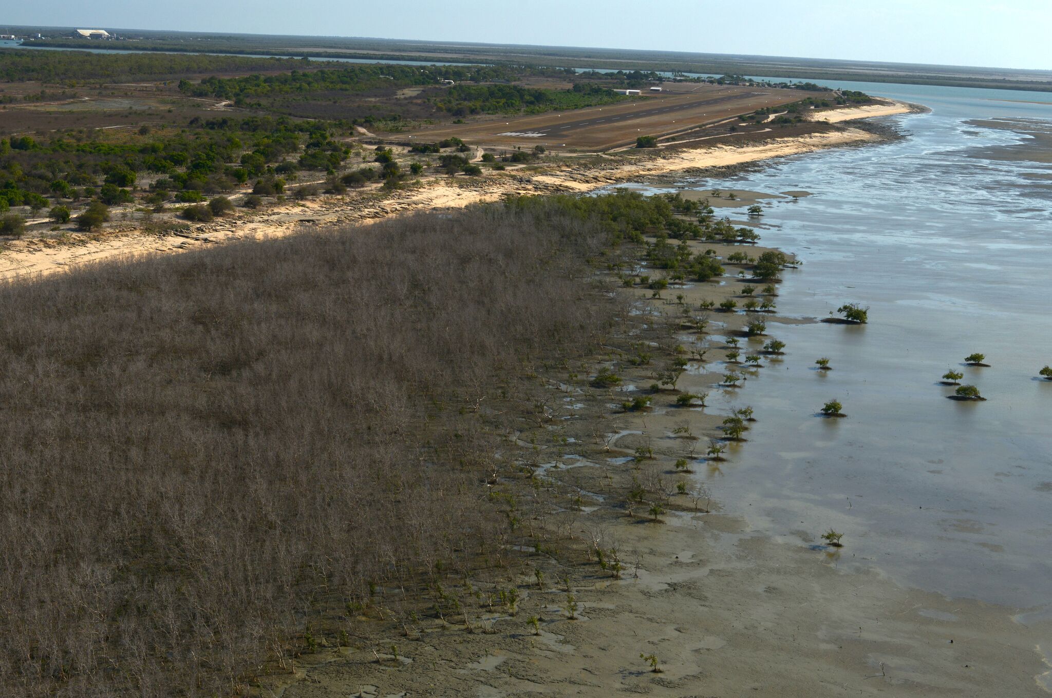
The research takes place after an enormous dieback of 7400 hectares of mangroves was discovered along 1000 kilometres of the Gulf of Carpentaria in 2016. Scientists believe this was due to persistent drought, high temperatures and the sea level dropping during a particularly strong El Nino year.
The Great Barrier Reef bordering the Cape York survey area has been severely damaged by bleaching events caused by a warming sea, but there has been no close assessment of neighbouring mangroves.
“Shoreline mangrove systems are essential for protecting threatened coral reefs. Healthy coral reefs need intact and healthy shoreline mangroves so they can better respond and adapt to warming sea temperatures,” said Dr Duke.
Capturing the Damage
Dr Duke said the JCU team will use MangroveWatch methodologies to assess and geo-tag mangrove and shoreline condition, including
- Getting “eyes on the ground” and increasing participants’ knowledge of mangrove ecosystems and local waterways,
- Assessing and detecting change over time,
- Monitoring the success of restoration/rehabilitation activities and management strategies,
- Identifying areas requiring greater protection and restoration, and
- Increasing scientific understanding of mangrove ecosystem function and resilience.
The plan is to capture aerial and on-ground high-resolution imagery for the compilation of a baseline list of key issues for environmental managers and locals.
“The information will be used to better inform future plans for on-ground projects involving key stakeholders, such as local Traditional Owner Ranger groups,” he said.
How you can help
As part of the project, the JCU team wants to hear from people about specific local issues such as emerging threats to high value tidal wetland areas of Eastern Cape York Peninsula.
Damage can be reported to mangrovewatch@gmail.com
Australian Government backing
The Australian Government has provided $110,000 to support this priority project under the Reef 2050 Plan. The project forms part of the Eastern Cape York Coastal Habitat Archive and Monitoring Program (CHAMP).
Article and photos supplied by James Cook University.
Back To Blog